Category:Images of maps of settlements
This category is for images of maps that depict settlements such as cities, towns and villages.
Subcategories
This category has the following 2 subcategories, out of 2 total.
Media in category "Images of maps of settlements"
The following 5 files are in this category, out of 5 total.
-
Gallisport map SWAJ6.jpg 439 × 733; 120 KB
-
Iritsa.jpg File missing
-
Isttu Village.jpg File missing
-
JanosMap.jpg File missing
-
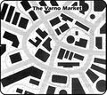
VarnoMarket-GG8p84.jpg 789 × 703; 146 KB


