Category:Images of maps of Colonies structures
Jump to navigation
Jump to search
This category is for images of maps depicting structures located in the Colonies.
Media in category "Images of maps of Colonies structures"
The following 6 files are in this category, out of 6 total.
-
Alaphoe Gardens map.jpg 873 × 605; 188 KB
-
Crispos Isle.jpg 598 × 916; 118 KB
-
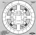
HejaranCastleFloorplan-TapaniSectorInstantAdventures.jpg 881 × 564; 95 KB
-
Hungry Herglic floorplan.jpg File missing
-
Melantha Hunting Lodge.jpg 592 × 560; 69 KB
-
Starseeker.jpg 518 × 622; 67 KB


