Category:Images of maps of the Mayagil sector
This category is for maps depicting the Mayagil sector.
Media in category "Images of maps of the Mayagil sector"
The following 22 files are in this category, out of 22 total.
-
 BajicOuterRim.jpg 400 × 148; 32 KB
-
 Bozhnee sector.jpg 250 × 250; 84 KB
-
 BremaOuterRim.jpg 401 × 166; 34 KB
-
 CorricOuterRim.jpg 400 × 153; 34 KB
-
 DeathSquadronQeimatHoth-TEA.png 1,871 × 1,189; 5.13 MB
-
 Eriadu Authority.jpg 400 × 700; 160 KB
-
 GarnibAtlas.png 331 × 259; 151 KB
-
 HookNebulaOuterRim.jpg 400 × 125; 30 KB
-
 Juris-EAOC.jpg 400 × 250; 33 KB
-
 KhuiuminOuterRim.jpg 400 × 226; 51 KB
-
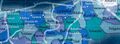
 MayagilOuterRim.jpg 400 × 187; 44 KB
-
 Outer Rim Sectors.jpg 1,350 × 1,728; 492 KB
-
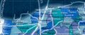
 ParmelOuterRim.jpg 400 × 146; 35 KB
-
 Rimma Trade Route.jpg 1,570 × 386; 55 KB
-
 SanbraOuterRim.jpg 400 × 166; 36 KB
-
 SarinOuterRim.jpg 399 × 167; 39 KB
-
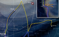
 SarinOversector.png 437 × 449; 404 KB
-
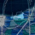
 SeswennaHydian.png 400 × 205; 174 KB
-
 Sluis sector.jpg 252 × 140; 36 KB
-
 TamarinOuterRim.jpg 400 × 288; 63 KB
-
 TheOuterRim.jpg 1,452 × 2,000; 1.28 MB
-
 ToblainOuterRim.jpg 400 × 217; 51 KB


