Category:Images of maps of the Anoat sector
This category is for maps depicting the Anoat sector.
Media in category "Images of maps of the Anoat sector"
The following 12 files are in this category, out of 12 total.
-
 AnoatSector.png 1,005 × 1,208; 2.41 MB
-
 AnoatSectorMap.jpg 1,255 × 1,640; 883 KB
-
 Bavva-GG.png 400 × 238; 132 KB
-
 Bozhnee sector.jpg 250 × 250; 84 KB
-
 Darlyn Boda.jpg 203 × 95; 20 KB
-
 DeathSquadronQeimatHoth-TEA.png 1,871 × 1,189; 5.13 MB
-
 GarnibAtlas.png 331 × 259; 151 KB
-
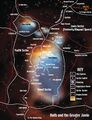
 HothGreaterJavin-TEA.jpg 1,137 × 1,600; 1.74 MB
-
 Lutrillian Cross and Kiax Nebula.jpg 883 × 845; 408 KB
-
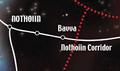
 Nothiin.jpg 372 × 340; 18 KB
-
 Outer Rim Sectors.jpg 1,350 × 1,728; 492 KB
-
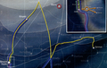
 ProbeDroidsMap-TEA.png 702 × 450; 969 KB


