File:TraganCluster-EAOC.jpg
Jump to navigation
Jump to search
No higher resolution available.
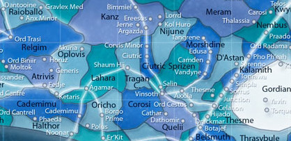
TraganCluster-EAOC.jpg (418 × 203 pixels, file size: 63 KB, MIME type: image/jpeg)
Summary
File history
Click on a date/time to view the file as it appeared at that time.
| Date/Time | Thumbnail | Dimensions | User | Comment | |
|---|---|---|---|---|---|
| current | 00:13, 21 February 2023 | | 418 × 203 (63 KB) | Maintenance script (talk | contribs) | == Summary == Importing file |
You cannot overwrite this file.
File usage
The following page uses this file:
Categories:
- Pages with missing permanent archival links
- Fair use images
- Images by Modi
- Images from The Essential Atlas Extra: Outer Rim Sectors
- Images of Agamar
- Images of the Akuria system
- Images of Anx Minor
- Images of Argazda
- Images of Axxila
- Images of Bimmiel
- Images of Borgo Prime
- Images of Botajef
- Images of the Braxant Run
- Images of Cademimu V
- Images of Camden
- Images of the Carosus system
- Images of Cathar (planet)
- Images of Celanon
- Images of the Celanon Spur
- Images of the Ciutric system
- Images of the Corvis Minor system
- Images of Dantooine
- Images of Dathomir
- Images of Despayre
- Images of Drackmar
- Images of Edusa
- Images of Er'Kit
- Images of Ereesus
- Images of Fedje
- Images of Feriae Junction
- Images of Generis
- Images of Gravlex Med
- Images of Harloen
- Images of Hijado
- Images of the Hydian Way
- Images of Jerne
- Images of Ketaris
- Images of the Kol Huro system
- Images of Kushibah
- Images of Lorrd
- Images of maps of the Atrivis sector
- Images of maps of the Belsmuth sector
- Images of maps of the Cademimu sector
- Images of maps of the Ciutric sector
- Images of maps of the Corosi sector
- Images of maps of the D'Astan sector
- Images of maps of the Esstran sector
- Images of maps of the Gordian Reach
- Images of maps of the Halthor sector
- Images of maps of the Kalamith sector
- Images of maps of the Kanz sector
- Images of maps of the Lahara sector
- Images of maps of the Meram sector
- Images of maps of the Morshdine sector
- Images of maps of the Nembus sector
- Images of maps of the Nijune sector
- Images of maps of the Noonian sector
- Images of maps of the Oplovis sector
- Images of maps of the Oricho sector
- Images of maps of the Quelii sector
- Images of maps of the Raioballo sector
- Images of maps of the Relgim sector
- Images of maps of the Sprizen sector
- Images of maps of the Thesme sector
- Images of maps of the Thrasybule sector
- Images of maps of the Tragan Cluster
- Images of Moltok
- Images of Noonar
- Images of Ord Biniir
- Images of Ord Cestus
- Images of Ord Radama
- Images of Ord Trasi
- Images of Outer Rim Territories star clusters
- Images of Phaeda
- Images of Pho Ph'eah
- Images of Polus
- Images of the Praadost system
- Images of Salin
- Images of the Salin Corridor
- Images of Serenno
- Images of Shaum Hii
- Images of the Simpla system
- Images of Sorrus
- Images of Tangrene
- Images of Thalassia
- Images of Thesme
- Images of Toprawa
- Images of Torque
- Images of Vandyne
- Images of the Veragi Trade Route
- Images of Vinsoth
- Images of Yavin Prime